

-Joseph Hatcher
BETA
Stream: The logistics for this run can be tricky, so it is rare for non-locals to get on, but keep it on your radar because if the conditions align it is a bucket-list run.
This run is more commonly done as a very long day trip by starting the hike before the sun comes up, but to really enjoy the run I highly recommend doing it as a 2, or even 3-day trip.
The first part of logistics is the shuttle, the take out is the town of Gasquet, and the shuttle takes paddlers up Patrick Creek and into Oregon. A gate is often closed 7 miles from the put in, making for a long hike, but high clearance 4wd vehicles can cut out the uphill portion of the hike and reduce the hike to 4 miles if conditions line up.
Hiking the part that is sometimes driveable.
The hike is all along road, the last mile or two is very steep and downhill. I found myself wondering what type of vehicle makes it up and down that last part, as it looked like it would be a challenge even for an ATV.
Once at Baldface Creek, there are some camping options where the trail meets the creek, Priscilla and I used an option on river-right. It also appeared there was a bench just below the first tributary on the right a couple hundred yards below the put in that would have decent camping as well.
Our spot.

The whitewater starts off easy, but fast and narrow. This warm up section lasts perhaps a mile and is class II-III. Things then gradually ease into fun class IV and stays that way for most of the rest of the run. The quality is high and there are some sections that we scouted.

There are a few class IV+ rapids (and some V at higher flows). The first couple big ones happen at islands, and occur in places where an aggressive boat scouter would find themselves reading and running before they realized they were out of eddies. Priscilla and I had no trouble getting out to scout them with our conservative approach to downstream progress.

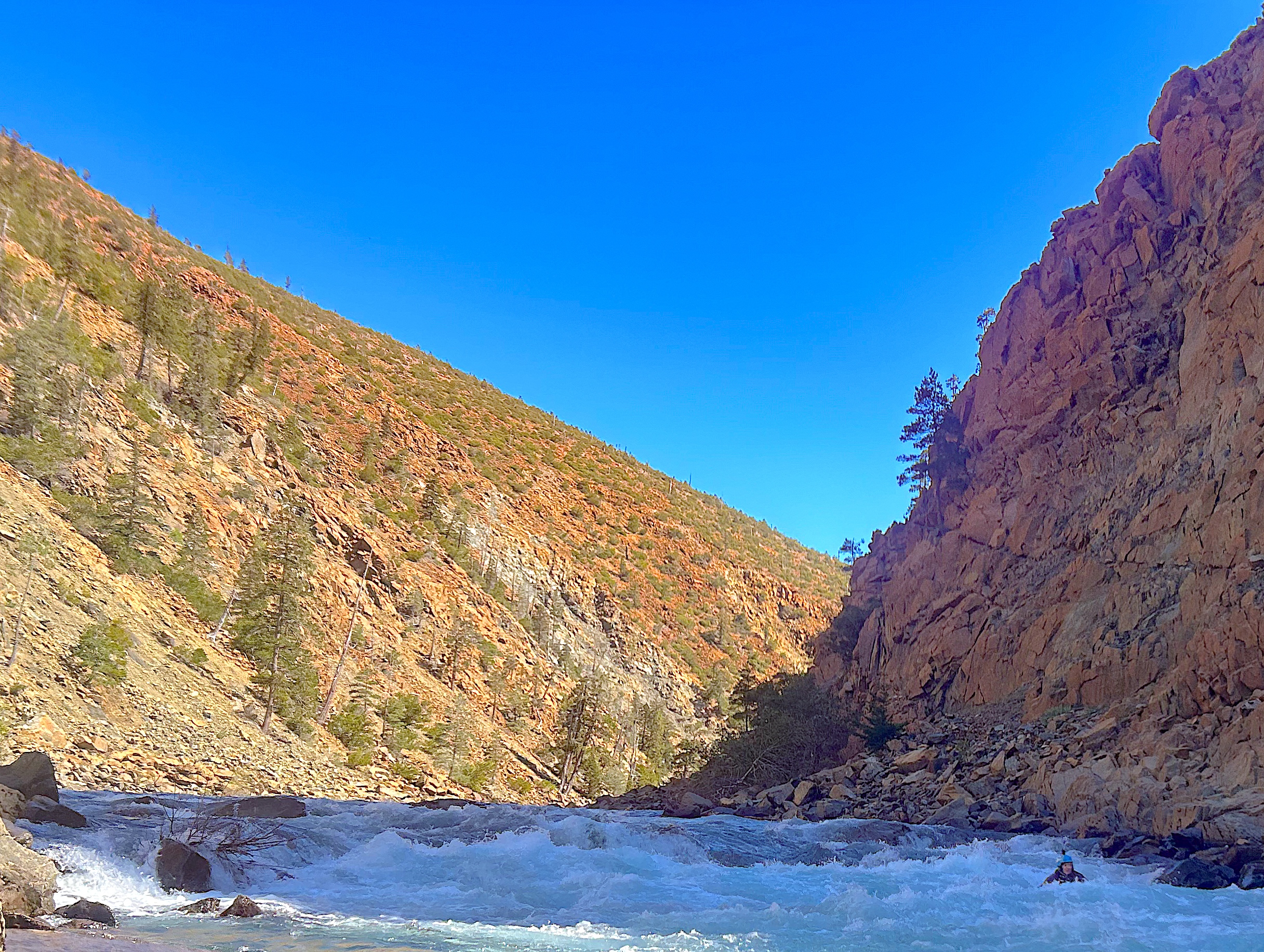
The Great Slide is the heart of the run, with a large section of mass-wasting occurring along the right slope of the creek, a bit over 4 miles into the run. Here there is a quarter mile of whitewater with large boulders and holes. At our level I felt comfortable running most all of it in a packraft, but I do think I did a short portage for a small move above a sieve. Priscilla was able to portage high on the left to start, then a couple more times at river level.

Below The Great Slide the run eases, and we grabbed a small campsite along a boulder bank on river-left not far downstream. The next section started off easier for awhile, and within a mile enters a forest that contrasts starkly with the open and burned section upstream.
Google imagery showing The Great Slide, and the transition from burn to forest.

This section is fun as well, with a class V rapid at "Bowman's". This one can be a little tricky to scout, and takes some creativity to portage without trudging through poison oak.

Around the corner is a ledge with a good sized hole best run on the right, then it's back to read and run to the confluence with the NF Smith at Sourdough Campground. Sourdough Campground requires high clearance to get to, and is time consuming, so most boaters paddle down to Major Moore's. The section of the NF Smith between Sourdough and Major Moore's contains one large rapid (class V). Scouting on either side requires delicate walking to maneuver around poison oak. If you are going to portage, left is probably better, but right can work with some ropes and teamwork.
The rapid (Sourdough Rapid) has many large boulders, and a couple of powerful rock ledges connected by fast and steep boogie.

Downstream of Sourdough Rapid are a few fun class III+/IV rapids with large boulders that can be read and run. After things ease off is one more fun rapid on a left bend shortly above the Major Moore Bridge that can be read and run through some fun crashing waves.
Downstream of Sourdough.

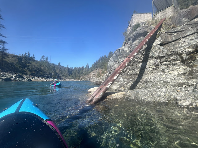
Boaters can take out at Major Moore's, but usually continue down through the classic section on the NF Smith.

Flows: The flows in Baldface Creek are somewhat related to the NF Smith flows, which are decently correlated to the Smith nr Crescent City gauge. Below is what we had, and I'd shoot for the same range of 10'-11' ish if I went again for a mostly class IV run with a couple class IV+/V- spots that can be portaged. Between 9-10' Baldface is still runnable but feels low and rocky.
If you want more of a class IV/V trip I'd think shooting for 13' or so would be a good bet, I'm not sure what the upper limit would be.
Take out level at the pipe in Gasquet, levels had held well enough, despite a gradual drop each day.
Access: We took out in Gasquet, and put in at the Mckee Cabin crossing. We had help from a shuttle driver, the route we took from the take out had us heading east on Hwy 199, then north up Patrick Creek until we reached Wimer Road. We took that west and north (do not drop down into the Diamond Creek drainage) until reaching a gate [42.01376032403267, -123.836118639887], which was open but was also at the point where the snow got deeper than we wanted to drive our Subaru Forester. From here we followed the mainline road to rd 494 which veers left [42.044658828995395, -123.84967050089946]. This took us over to Biscuit Hill [42.057675045595246, -123.8846884289238], from which point the road is marked as a trail on most maps, and drops steeply down to Baldface Creek[42.06874786475997, -123.89274449081843].

Take out level at the pipe in Gasquet, levels had held well enough, despite a gradual drop each day.

Access: We took out in Gasquet, and put in at the Mckee Cabin crossing. We had help from a shuttle driver, the route we took from the take out had us heading east on Hwy 199, then north up Patrick Creek until we reached Wimer Road. We took that west and north (do not drop down into the Diamond Creek drainage) until reaching a gate [42.01376032403267, -123.836118639887], which was open but was also at the point where the snow got deeper than we wanted to drive our Subaru Forester. From here we followed the mainline road to rd 494 which veers left [42.044658828995395, -123.84967050089946]. This took us over to Biscuit Hill [42.057675045595246, -123.8846884289238], from which point the road is marked as a trail on most maps, and drops steeply down to Baldface Creek[42.06874786475997, -123.89274449081843].
I highly recommend bringing a dynamic map downloaded to your phone for the hike and shuttle, I like the free Gaia app. Here is a static map showing the route after turning off the mainline access road.

----------------------------------------------------------------------------------------------------------------------------------------------
Story/Notes
----------------------------------------------------------------------------------------------------------------------------------------------
----------------------------------------------------------------------------------------------------------------------------------------------
Our friend sent us an email about his trip on Baldface Creek and had this to say about it "I do believe this is the best class 3/4 wilderness run I have ever done to date.". He has paddled extensively across the country, including many of the high Sierra Rivers. With this endorsement I knew Baldface is something I needed to do.

We got a unique and ideal weather window in late March 2024. Good looking flows combined with sunny skies and high for the time of year temps. We planned on 4 days since we had ambitions in the area other than Baldface, but due to the loss of an integral piece of gear ended up using all those days on Baldface.
Day one we met in Gasquet and were shuttled up to the gate on the way into Baldface.
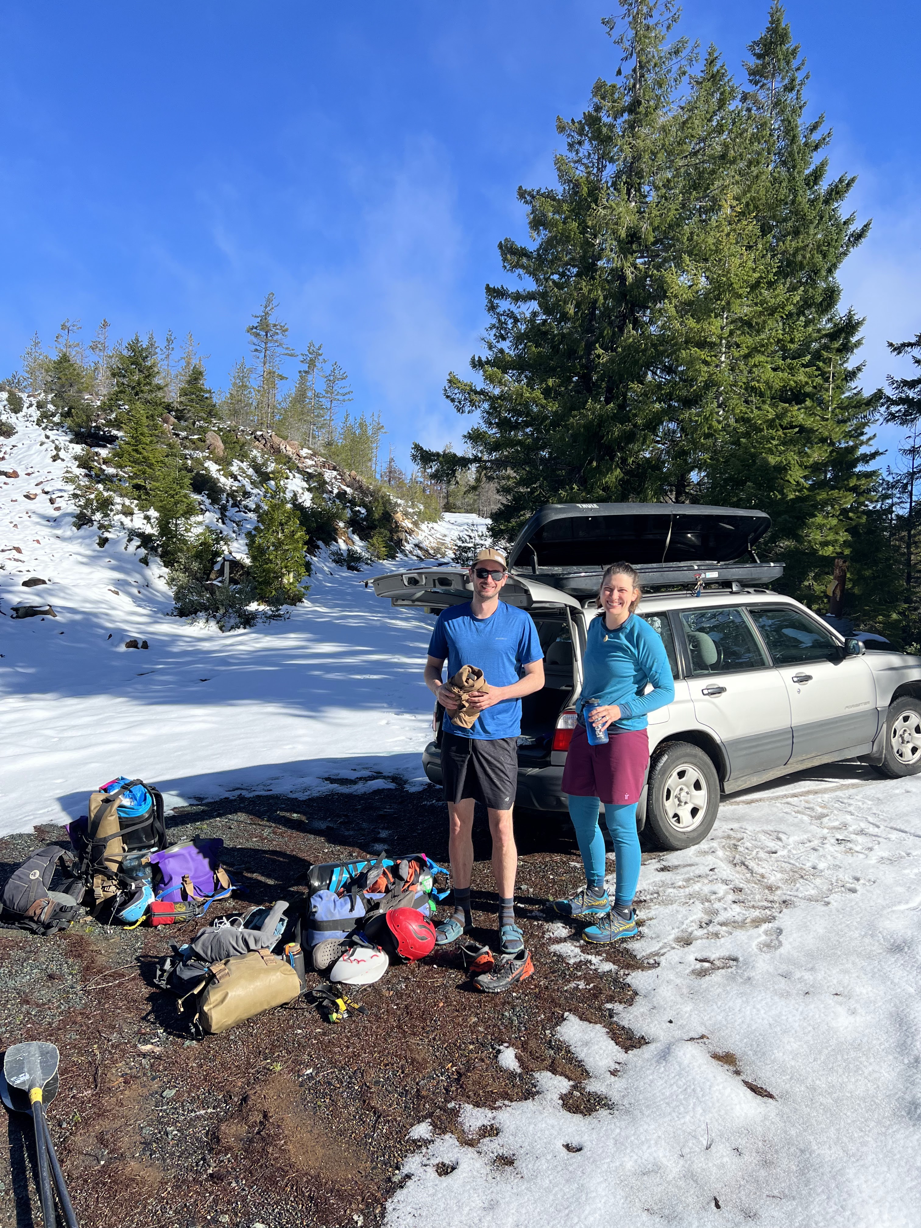
Photo: David Gastineau
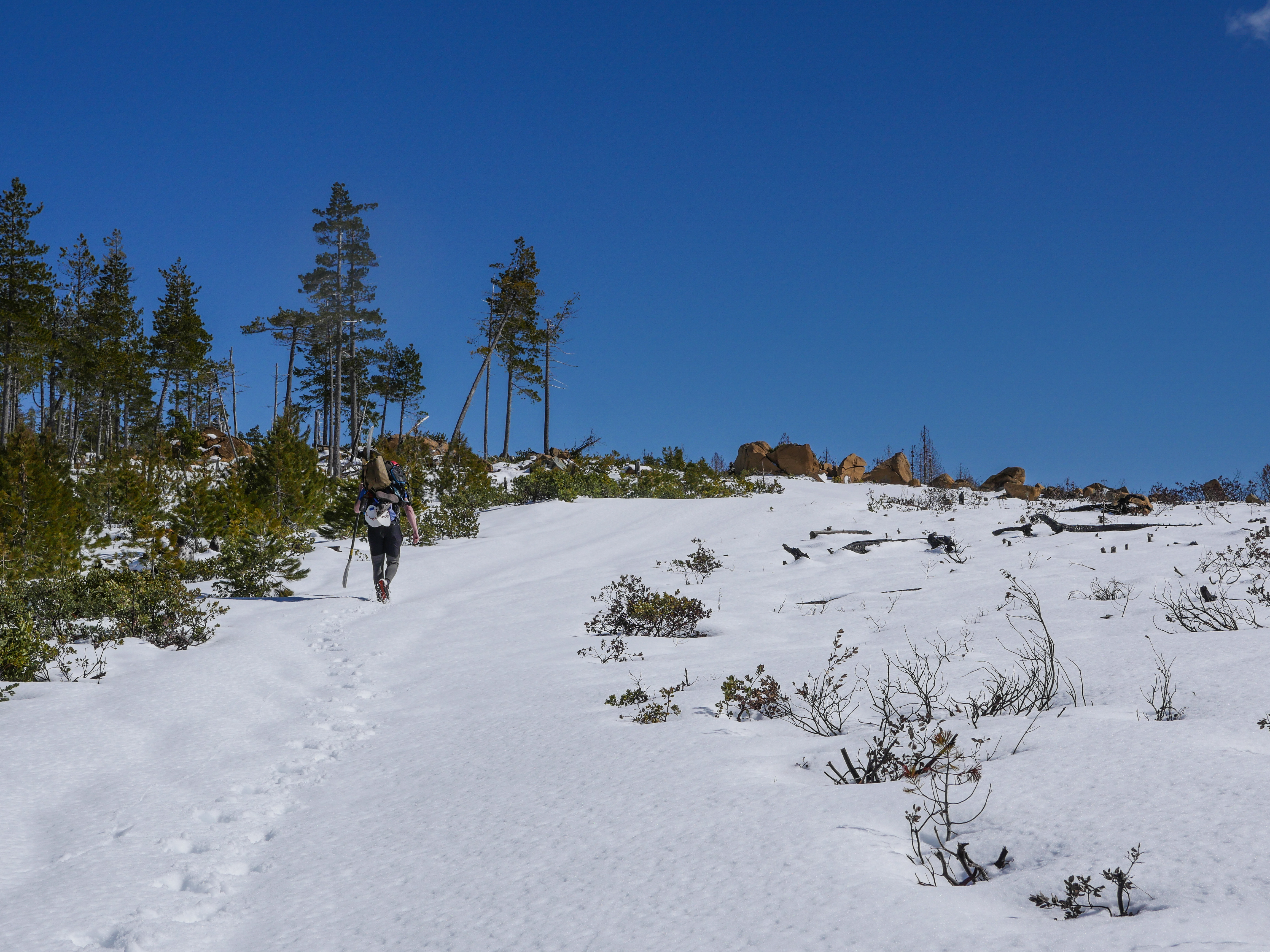
From here we through our packrafts and gear in a pack and headed up the road. The snow deepened in spots, but was pretty reasonable walking. After some gradual uphill, there was a steep bit in the road that lasted for awhile, and I felt like we reached a benchmark when the road platued.

If I had known what was waiting for us up there, I might have reconsidered doing the trip. The snow was deep, deep enough that we were postholing and did not reach the gravel of the road with our feet, in placed when I wasn't careful or the snow was particularly soft I'd sink below my knee. It was of an awful consistency, where it would nearly support our weight, but as soon as we lifted the second foot we would break through the surface and sink. This lasted for 2 miles and was genuinely challenging.
If giving up had been an option, we would have considered it. All this snow ended up being a good thing later on though, as the warm temperatures were melting the snow and giving us good water levels while on the creek. After the flat and snowy 2 miles up on the plateau, we began to drop down to the creek.
The road was under there somewhere.

We had told ourselves as we lost elevation the snow would disappear, but we were now on a north facing slope and the snow did not disappear. The difficult hiking and slow progress continued, and required some mental fortitude.
Eventually the snow did recede.

We were spent at this point, and while some food helped the going was rough after this given our physical state even though the walking conditions became easier. The last couple miles were very steep downhill, we were all too ready to reach the creek. We had just enough time to ferry our gear across the creek and set up camp on the other side before it got dark. The hike had taken all day and for some reason we had only shared one Nalgene worth of water.
Miner's campsite

The next day we got on the water and were happy for the snow we had hiked through, flows had not dropped much at all overnight. Things looked tight and blind at the put in, so we feared for wood, but things quickly opened up into easy read and run with good visibility. After a mile or so of warm up things picked up towards class IV, and we had our first scout on a right-hand turn at a rapid that ended at the confluence with Taylor Creek. This turned out to be a fun rapid, and felt like my first real rapid I had run in a packraft (this was my first packrafting trip). The rapid went well and I gained some confidence in the boats performance.

More good rapids waited downstream and we were having fun. Before long we came to a rapid that dropped steeply to the left at an island and created a bit of a horizon. We scouted right, and saw the creek dropped through a few significant but manageable holes. We thought if we pushed left we could hit the friendliest parts of them. Priscilla followed me into the rapid, and as I boofed over each hole I was both happy with how the boat handled, but glad I was getting a good stroke in at each hole. I eddied out at the bottom left and looked back to see Priscilla upside down. I got out of the creek quick as I could and got ready to throw her a rope, but she had already gotten to the right bank, sans her boat or paddle. I had to quickly decide whether to go after her boat with all her camping gear and food, or paddle. At the time it felt like an easy decision to go after the boat, which I got to shore before the next rapid and pulled it on the bank. I jumped back in quickly and took off after her paddle, starting to think I may have made the wrong choice, as our paddles are black and hard to see. I looked for a couple hundred yards and saw nothing, and felt the need to check back in with Priscilla before I got too far downstream. I scanned for the paddle as I walked back upstream but didn't see anything. I helped reunite Priscilla with her boat and we got out our spare paddle, which was in fact a set of hand paddles our friend Kory Kellum had made and gifted to us. Priscilla paddled down to where my boat was, and wanted to check out the shallow left side of the creek for awhile which had many bushes where her paddle could have ended up. After half hour of searching or so she gave up and we accepted that she would be hand paddling the rest of the trip.
Rattletrap, the rapid that got Priscilla.

The plan would be for her to paddle the easy rapids and go eddy to eddy. She would portage anything challenging, or I could run my paddle back up to her. We were lucky that walking along the bank was usually easy at our flow, and fortunately the plan worked because we never saw that paddle again (AT Geronimo zero degree in case someone sees it on a NF Smith trip).
In hindsight, it would have been better for me to go after the paddle first, then track down the boat since it was bouyant and brightly colored, lesson learned yet this was working out ok.
This was all going well and we were actually having fun, she adapted to the hand paddles quick enough, and was running plenty of class III-IV.

We made it down to the Great Slide late in the day. This was the only tricky portage for Priscilla. Having chosen not to run the lead in rapids, she was forced to get above the small cliffs on river left and walk a bench down to below the first notable rapid along the Great Slide. I helped her portage a bit through here, then things eased off and we decided to make camp along a cobble bench on river-left that had a bit of sand.
Campsite with the Great Slide visible in the background.

The next day was more of the same, she was able to run 80-90% of the creek with the hand paddles. I did a partial portage at Bowman's, and Priscilla did a full portage that required some creativity on river-left.

We put back in just below and while attempting to ferry over to river-right she flipped again and swam right away, popping up with only one of her hand paddles. After getting her to shore I went running down the bank hoping to see the missing hand paddle at the bottom of the creek (the water was very clear) below the next rapid. 10 minutes later and we had given up that hope. We were deep in it now, and I started calculating the difficulty of our hike out. I thought it might take a couple of days. While Priscilla makes more errors than she would like on the river, she is also a very determined person, especially in a situation like this. She set her mind to finding a piece of tree bark to use as a make-shift hand paddle. She found one that she thought would do the trick and we set about lashing it to her hand. We did it in such a way that she could still pull her skirt if needed.

At about this moment she called out, she saw something flash white at the bottom of the river. Amazed that this was probably the missing hand paddle, I grabbed the end of a throw bag, handed her the other side of it and dove to the bottom of the creek before the sunken plastic could get away from us and into the next rapid.
Breaching the surface with our temporarily escaped hand-paddle dropped a weight from our shoulders, it had been awhile since we had been in that tight of a spot.
Priscilla cinched up the hand paddles as tight as they would go and we proceeded downstream, determined not to make any more errors.
As I recall the whitewater eased as we approached the confluence with the NF Smith. We considered camping at Sourdough Campground right there at the confluence but decided to try and make some more progress so that we didn't have any unknown (to us) whitewater to deal with the next day.
Confluence with the NF Smith.

We got to Sourdough Rapid, and scouted from the right bank. It's a good sized rapid and we couldn't get a good view of the first powerful ledge so both portaged that. I decided to run the rest of the rapid, but it was too much for Priscilla and her hand paddles so we sorted out the portage along the right bank. Getting around the first poison oak patch was the first crux, followed by some straight forward boat passing along the steep bank, ending in some ropework to get the boat and Priscilla to a ledge just above water level. Portaging along the left bank looked like it would have been easier.
I went back up and ran the lower class IV+ part of the rapid, which I found challenging but fun in the packraft, then we continued through the fun read and run class III+/IV section of rapids downstream.
Sourdough Rapid.

We found an amazing campsite about a mile upstream of Major Moore's, but got spooked by the multiple bear tracks and decided to head downstream and camp at Major Moore's.
Bear track camp.

Major Moore camping.

The next day we paddled the classic section of the NF Smith, which was a lot of fun, but presented some unique challenges for Priscilla and her hand paddles. The class III/IV run had a lot more class IV at the flow we were there than I had expected, which was both a blessing and a difficulty. Priscilla portaged every once in awhile, but ran most of the rapids.

There were more large ledge holes than I remembered, and after boofing over a particularly notable one I signaled back to Priscilla that she should walk it, too late. She was already committed and put all her gumption into her two handed boof and road a big stern squirt out of the hole, bringing it down with a smile.
Another quality NF Smith rapid.
We were pretty happy when we reached the lazy floating at the end of the run, excited to complete this fun-run turned adventure.

Priscilla had done a fine job on the NF Smith, and made it to the take-out with both hand paddles.

1 comment:
One of the best adventures of my life! Rumie Tours made the Piton hike exciting and the mud bath incredibly soothing. Will definitely book with them again next trip!
Go Piton Hike and Mud Bath
Post a Comment