Is it a river? A sewer? A flood control channel? A place to film awesome drag racing scenes? A tool of gentrifiers to raise property values? What's the deal with the L.A. River, and why should I care about it? Let's find out.
In these challenging times, the need for reliable local reporting has never been greater. Put a value on the impact of our year-round coverage. Help us continue to highlight LA stories, hold the powerful accountable, and amplify community voices. Your support keeps our reporting free for all to use. Stand with us today.
Is it a river? A sewer? A flood control channel? A place to film awesome drag racing scenes? A tool of gentrifiers to raise property values? What's the deal with the L.A. River, and why should I care about it? Let's find out.
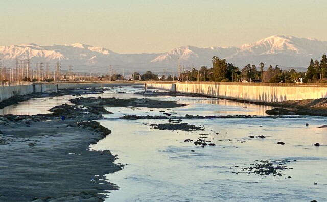
The L.A. River is shaped like a comma. It begins in the western San Fernando Valley at the foothills of the Simi Hills and the Santa Monica and Santa Susana Mountains. It flows east, curving around Griffith Park and passing beneath the foothills of the San Gabriel Mountains before flowing south all the way to Long Beach and the Pacific Ocean.
Two main sources: rain and wastewater treatment plants.
When it rains up high in the mountains that ring the Los Angeles Basin, the water flows downhill, first in tiny rivulets, and then making its way into larger and larger creeks. The creeks flow into each other, becoming larger and more powerful. And eventually, they flow together to form the Los Angeles River.
But in the summer, when it doesn't rain in Los Angeles, the river doesn't just run dry. Instead, it's fed by wastewater discharged from three wastewater treatment plants in L.A., Burbank and Glendale. This water is typically cleaner than water that flows into the river from city streets and storm drains (more on this later).
If it flows with treated wastewater down a concrete channel, is it really a river?
The LA River flows through the Frogtown neighborhood in Los Angeles. The river's banks are mostly concrete.
(
Andrew Cullen
/
For LAist
)
I know it doesn't look like it anymore, but more than 80 years ago the river was, in fact, a legit river. Before Europeans arrived, the Gabrieleno-Tongva Mission Indians lived along the river. Tribal member Mark Acuna told KCET that back then, the L.A. Basin was lush, thick with "great reed forests so thick that Spanish talk about it would take days to cross through them."
The river was thick with steelhead trout, which are now endangered, and the forests were home to bears, mountain lions and deer.
Wow, that sounds pretty interesting. What happened?
Europeans showed up. Spanish colonists founded the Pueblo of Los Angeles along the L.A. River in 1781, and it was the primary water source for the growing city until 1900. Over time, people built homes closer and closer to the river's banks--dangerously close, because the L.A. River can grow from a trickle to a raging torrent in just a few hours.
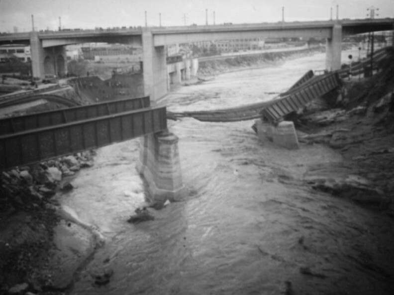
And that's exactly what it did in February 1938, after it rained more in a single day than it normally did in a year. The river surged beyond its banks. It took out bridges. It took out houses. It flooded Echo Park and Venice and surrounded Warner Brothers Studios like a moat. According to the L.A. Times, "so many Hollywood stars were stranded at their ranches in the Valley and elsewhere that the Academy Awards presentation scheduled at the downtown Biltmore Hotel was postponed for a week."
Southern Pacific's Dayton Avenue railroad bridge, located near Elysian Park, collapsed when the banks of the L.A. River eroded after heavy rains.
(
Herman J. Schultheis Collection
/
Courtesy of the Los Angeles Public Library
)
At least 96 people died, and more than 1,500 homes were destroyed.
The flood marked the end of the river being a river. Afterwards, the dam-building, river-righting men at the U.S. Army Corps of Engineers began encasing the river in a deep concrete channel that would keep it from spilling out of its banks during future floods. They erected fences and put up "No Trespassing" signs. It took 20 years and 3.5 million barrels of cement, according to "The Los Angeles River, Its Life, Death and Possible Rebirth," but by the end the river had been erased, transformed from an ecosystem into a freeway for moving floodwater efficiently and safely from mountains to the sea.
So when did the river begin to come back to life?
In 1985, a writer named Lewis MacAdams took a pair of wire cutters and two friends down to the river and cut a hole in the fence. According to the nonprofit he founded, Friends of the Los Angeles River, "Lewis and two friends, whiskey in their blood and wire cutters in their hands, cut a hole in the surrounding chain link fence that had defined the river as an inhospitable drainage ditch. With one fell snip, MacAdams declared the L.A. River "open for the people."
MacAdams began advocating for the restoration of the river, and in 1997, L.A. County produced a master plan outlining how exactly that would happen. That same year, the first stretch of bike path opened in the Elysian Valley section of the river.
But the U.S. Army Corps of Engineers argued that the river wasn't safe for people, except in two small sections. In response, satirical writer George Wolfe and a rogue Army Corps biologist, Heather Wylie, decided to kayak the entire thing, to prove the Army Corps wrong. They set out from Canoga Park in July 2008 and reached Long Beach three days later. Former LAist photographer Tom Andrews documented the entire thing.
The crazy stunt worked: Two years later, in 2010, the EPA declared the entire river to be "traditional, navigable waters," overturning the Army Corps' decision.
And in 2011, the river finally opened to kayaking, for the first time since it was put into its concrete channel.
A cyclist takes the bike lane east on the 6th Street Bridge, which crosses the LA River, connecting the Arts District and Boyle Heights.
(
Ryan Fonseca
/
LAist
)
What you can (and can't) do
So can I swim there now?
Absolutely not. "Swimming is not allowed in the L.A. River," cautions the Los Angeles River Recreation Zone website.
So tell me about the kayaking
Yep, you can do it, but only in two sections of the river: Elysian Valley, from Fletcher Drive to Steelhead Park (which is just off Oros Street in Frogtown), and in the San Fernando Valley within the Sepulveda Basin Recreation Area, from Balboa Boulevard to just west of Woodley Avenue. The Lower L.A. River may one day be open to kayaking, but right now it's closed. Kayaking is allowed from Memorial Day through the end of September, according to the LARiverRecreation.org.
Can I take my own boat or do I have to go with a guide?
You can take your own kayak, rent one, or go with a guide.
L.A. River Expeditions runs guided trips in both Elysian Valley and Sepulveda Basin.
Sadly, no. Only "non-motorized, steerable boats such as kayaks or canoes" are permitted. The three guys who paddled down the section of the river that flows through Vernon in a pink inflatable flamingo in March 2018 broke all the rules: wrong season, wrong place, and wrong type of boat.
It was pretty awesome, though.
What sort of wildlife might I see on the river?
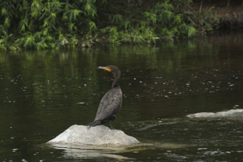
There are a ton of birds that live in or visit the L.A. River, including the iconic great blue heron, which lives in huge, treetop nests in riverside neighborhoods. The birds you'll see depend on where you are on the river, as Kimball Garrett of the Natural History Museum told KCET. In the parts of the river that are soft-bottomed, meaning they aren't completely lined by concrete, you'll see a lot of duck-like species like mergansers, buffleheads and grebes. But in the completely channelized sections, where the water is shallower, you're more likely to see sandpipers and other long-legged waders.
The section of the Los Angeles River flowing through the Frogtown neighborhood in Los Angeles is home to an assortment of birds, including this cormorant.
(
Andrew Cullen
/
For LAist
)
There's also a lot of fish — mosquito fish and tilapia are the most common, but you'll also see huge carp, fathead minnow and green sunfish.
You can watch a cool time lapse that KPCC made of a previous monitoring project back in 2015.
Can I fish in the river? And can I eat the fish I catch?
Yes, you can fish in the river — just get a state fishing license. As for eating the fish, it really depends on who you ask. Some say it's good eating, while others describe it as an "enter at your own risk" and advise "catch and release" as the safest course of action.
Want more info? The California Environmental Protection Agency's Office of Environmental Health Hazard Assessment issued an advisory back in September noting that "...like fish all over the world, California fish also have detectable levels of contaminants," and goes on to issue guidelines that are likely to ... dampen your appetite for locally caught seafood.
A can floats in the L.A. River near a fisherman, and serves as a reminder to us all: Do not litter!
(
Andrew Cullen
/
For LAist
)
How safe is the water for me?
Just cause it's legal to kayak the river doesn't mean it's always a good idea. The Army Corps of Engineers closes the river for up to 72 hours after a rain, when the concrete channel fills to the brim with raging flood waters (this is why the channel was built in the first place, remember)? The river is also closed when E.coli bacteria levels are high enough to make you sick. You can check the levels on this website.
It's a color-coded system:
Red means the riverbed is closed: no kayaking, wading, or otherwise getting in the water is allowed. Bacteria levels are at least twice the federal safety limit.
Yellow means proceed with caution. Bacteria levels are up to twice as high as the federal safety limit.
Green means go! Bacteria levels are below the federal safety limit. But, to repeat, there's still NO SWIMMING allowed.
Even if bacteria levels are within federal safety limits, try to avoid touching the water or getting it in your mouth. Ingesting E.coli can cause diarrhea, vomiting and fever.
Speaking of water quality: How dirty is it?
E.coli bacteria levels in the river can exceed standards meant to keep swimmers safe.
"Unfortunately, many freshwater recreation sites in L.A. County suffer from fecal indicator bacteria (FIB) pollution, which indicates the presence of pathogens that can cause infections, skin irritation, respiratory illness, and gastrointestinal illness," according to the 2021 River Report Card from Health the Bay. In particular, the L.A. River at Rattlesnake Park received a failing grade for a fourth consecutive year. Why? "This popular site for fishing, kayaking, and wading receives a steady stream of bacteria pollution from the nearby Fletcher Dr. storm drain," according to the Heal the Bay report.
Bacteria is far from the only thing sullying the L.A. River's waters: There are many different pollutants that violate federal standards, including: ammonia, metals, trash, algae, oil, pesticides, insecticides and a number of volatile organic chemicals.
What are some of the oddest things pulled out of the river?
According to L.A. Waterkeeper, L.A.'s water watchdog, workers have recovered such nonsense as trampolines (yes, plural), rolled up carpets (yes, plural), a dirt bike, 1980s-era computers, flip phones and lots and lots of shopping carts (yes, yes, yes, all plurals).
"Every once in a while we take something home as a treasure from the river," said Marissa Christensen, on the board of directors of the Friends of the L.A. River, which runs annual river clean ups. One of her favorites: "a gold, ceramic figurine with a bunch of goats climbing a mountain. It's really kind of random, but cute."
BTW, if these water pollution issues strike a chord with you, know that these water monitoring groups are always looking for volunteers. Here is how you can sign up for the L.A. Waterkeeper newsletter and follow the Friends of the L.A. River blog. And here's how you can get involved with Heal the Bay's activities.
Who's in charge of cleaning up the river?
Getting anything accomplished on the L.A. River is a challenge, because there are so many different cities and government agencies with jurisdiction. In addition to the 17 cities the river passes through, there's also five additional county, state and federal agencies, plus some others we probably forgot.
"It's like lasagna," said Fernando Gomez, now the chief ranger for the Mountains Recreation & Conservation Authority. "You've got multiple layers of entities interested in the L.A. River. Everyone wants to have a say."
That said, the Los Angeles regional branch of the State Water Resources Control board ultimately has the responsibility for bringing the river into compliance with the federal Clean Water Act's water quality standards. And, no surprise, resources are always an issue.
Why is it so hard?
Household items sit in a storm drain along the LA River in Frogtown: Trash that isn't properly disposed of often ends up fouling our rivers and oceans.
(
Andrew Cullen
/
For LAist
)
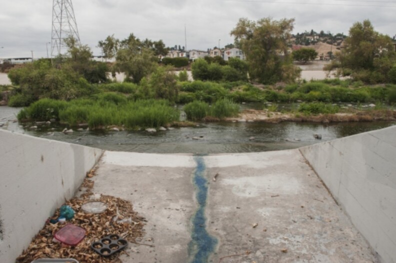
Because the pollution comes from so many different sources. Most of the gross stuff flows into the river from city streets and some 2,000 storm drains. LA's concrete jungle contributes to the problem: with 60% of the river's watershed paved over or developed, contaminated water can't be absorbed into the ground, so it runs off into the river.
Restoration efforts
Is restoration of the L.A. River leading to gentrification?
Causation is really difficult to show, but the two things do seem to be happening at the same time. Robert Garcia, founding director of The City Project, dedicated to justice, democracy and livability in L.A., found that the percentage of non-Hispanic white people has increased dramatically from 2006 to 2016 in neighborhoods near the L.A. River in Northeast L.A., where most of the revitalization efforts are directed, even though the county itself has gotten less white over that same period.
This is bad news, Garcia said at the time of the report, because revitalizing the river has the potential to improve the lives of everyone leaving nearby by lowering urban temperatures through the planting of trees, providing clean, safe places to exercise, and providing the mental health benefits of being outside in nature.
Level with me here: Why should I care about the L.A. River? Is it just a weird, local curiosity? Or does it impact my life?
If you live in cities along the 710 corridor like Maywood, Huntington Park, Bell Gardens, Lynwood or Compton, a restored L.A. River is probably the best chance you have for adding parks and greenspace to your community. And parks and open space have huge public health benefits.
But bringing back the L..A River is also a way to combat L.A.'s culture of forgetting and erasing our history, as nature writer Jenny Price put it 17 years ago.
"What makes the L.A. River so peerlessly amazing is that its city actively 'disappeared' it: We stopped calling the river a river. And it all but vanished from our collective memory. ... This act is unparalleled: A major American city redefined its river as infrastructure; decreed that the sole purpose of a river is to control its own floods; and said its river now belongs in the same category as the electrical grid and the freeway system and will forthwith be removed from the company of the Columbia, the Allegheny, the Salmon. In a city with a notorious, extreme tendency to erase both nature and history, L.A.'s ultimate act of erasure has been not just to forget but to deny that the river it was founded on runs 51 miles — 51 miles! — right through its heart."
This story was initially written and published in 2018 as part of Elemental: Covering Sustainability, a multimedia collaboration between Cronkite News, Arizona PBS, KJZZ, KPCC, Rocky Mountain PBS and PBS SoCal. It continues to be one of the most popular pieces on our website, so in early 2023 we updated it to include, among other things, the latest advisory on eating fish caught in the L.A. River.
What questions do you have about Southern California?
Since 2021, volunteers have been planting Joshua tree seedlings in the Mojave Desert burn scar. The next session is slated for later this Spring, according to the National Park Service. Just like previous times, a few camels will be tagging along.
There are three main meteorological reasons why L.A. is so smoggy — all of which are affected when a rainstorm passes through and brings clearer skies.